Blog
Geocode addresses and export GPS coordinates
This paper describes the method of using the Open Street service for geocoding postal addresses, ie obtaining valuable GPS coordinates (latitude, longitude) for positioning them on a map. Geographical notions What you need to know about geocoding Geocoding...
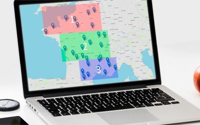
Sectorize points into zones by their GPS coordinates
In the context of mapping tools, sectorization is an operation which makes it possible to group points by geographical areas. There are different possibilities to group the points according to the desired criteria: by country, region, postal code, city, etc. Here we...
Discover the menu of the Open Street application
The Open Street application consists of a menu on the left side of the screen, as well as the map displayed on the rest of the screen. Description of each menu as well as the possibilities offered by the application. To begin, we recommend that you open a customer...
Importing an Excel Address File
A key feature of the Open Street application is the import of Excel files containing the addresses to be entered on the map. If it is possible to enter addresses using the keyboard, it is by importing files that you can save time and position on the map several tens...
Create a customer account and access your personal space
Here's how to create a customer account (or user account) on our web application, and access your personal space to view your information, check the remaining credit, and possibly deposit credits to use our advanced features. Using the registration form The...
Secure HTTPS for Open Street
The entire Open Street site has evolved to use the latest web security standards with regard to encrypted exchange of information. This evolution accompanies the security shift that has been taking the Internet for several years, a shift probably helped by the latest...
Empty the browser cache in case of a problem
Reload the Page To accelerate navigation, the most common Internet browsers store the information seen on the internet so that they do not have to be re-downloaded. This is called the browser cache. Most of the time, this is a good thing that makes the user experience...
File formats to import addresses
To make route calculations and optimizations on a large number of addresses, it is much more convenient to create a file on your computer that contains the addresses to be imported, download it to our online service and import several addresses a click. Excel file...
Export of the route: Waze, GPS, Google Maps, Bing, …
Since the third version of the Open Street service, released at the end of January 2016, it is possible to export routes. First of all, the global route consisting of all its steps can be exported in ITN and GPX format. The format ITN was created by Tomtom to import...
Postal address format for Open Street
Mailing addresses in Open Street The Open Street online service allows you to optimize itineraries through the addresses of your choice. When entering or importing these postal addresses, you must be very careful about the format of the address, as the service...
Prediction of the processing time of the optimization API
Average calculation time On our optimization API, each calculation request takes a time that is predictable as it depends on the number of points per calculation. The calculation formula is a simple polynomial of the second degree. Let x be the number of points per...
Usage quotas for our API
Our different Open Street APIs are available to our clients/customers for a monthly fee that meets their needs. It is also possible to open a temporary demo account to companies who request it. The pricing of the package depends mainly on two parameters: The maximum...
Energy management and tour optimisation
The international regulatory environment adapts to the environmental issues that are increasingly present in our immediate environment. The Kyoto Protocol, and more recently the environmental Grenelle round table, are collective approaches defining new actions for...
The price of oil increases; Lower your fuel costs
At Open Street, we try to describe the strengths of our service in everyday life. But we talk a little less about the profound global changes that motivate us to improve this service. They are naturally ecological and economic, and one can not go without the other in...
Features of the online application
Detailed description The Open Street online application is accessible from a computer, a tablet or a mobile, using a recent browser such as Firefox or Chrome. It makes it possible to optimize routes by road, ie it finds the best possible route passing through your...
The Graph Theory in the Open Street web application
This page explains how the Open Street service uses mathematical tools, such as graph theories, to describe the problems of the commercial traveler hidden behind each optimization calculation. It allows you to model and then solve problems as you enter them into our...
Complexity of the Traveler Salesman Problem
Open Street allows you to find the shortest path through a given city list. This problem of optimization is commonly called « problem of the commercial traveler » by the mathematicians. It is known to be an NP-complete problem, ie there is currently no algorithm that...


