In a nutshell...
Open Street finds the shortest itinerary in order to save time and fuel. Like Google Maps, but for a few hundreds addresses.
Optimize your road tours
Open Street is a web application for optimizing road trips. It shows the shortest path between many addresses or GPS coordinates. It can be used for personnal or professional cases.
This tool, which can be used by carriers, delivery personnel, sales representatives, salesmen, will allow you to reduce traveled distance, to save time, fuel, and money. For important optimization needs or for access to our APIs for developers, we can make a customized quote
Many improvements are developped periodically. Open Street aims to become a simple service to optimize itineraries for all types of sectors (commercial, maintenance, transport) and to allow substantial savings by calculating the best routes trips with many stops.
Feel free to contact us to find out how our solution can help you.
Our web application
Open Street is a web application accessible from a computer or a tablet, with a recent Internet browser like Firefox or Chrome. Discover the application.
Our optimization APIs
You might want to include these features in a software or application of your creation. We can provide you with the APIs that form the core of our optimization system to embed our technology: geocoding, distance calculation, journey optimization, with a billing method by use or by flat rate. Learn more.
Our recent articles
Geocode addresses and export GPS coordinates
This paper describes the method of using the Open Street service for geocoding postal addresses, ie obtaining valuable GPS coordinates (latitude, longitude) for positioning them on a map. Geographical notions What you need to know about geocoding Geocoding...
Sectorize points into zones by their GPS coordinates
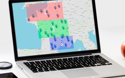
In the context of mapping tools, sectorization is an operation which makes it possible to group points by geographical areas. There are different possibilities to group the points according to the desired criteria: by country, region, postal code, city, etc. Here we...
Discover the menu of the Open Street application
The Open Street application consists of a menu on the left side of the screen, as well as the map displayed on the rest of the screen. Description of each menu as well as the possibilities offered by the application. To begin, we recommend that you open a customer...
Why
Your GPS will take you to the right destinations, but not in the right order? You need a solver such as Open Street.
How
The Open Street service works with powerful servers that optimize your journey for you. Trust our engineers to improve your journey by road.
Quick
Optimizing a trip of 100 stops in a few minutes, it is possible!


