Detailed description
![]() The Open Street online application is accessible from a computer, a tablet or a mobile, using a recent browser such as Firefox or Chrome. It makes it possible to optimize routes by road, ie it finds the best possible route passing through your rendezvous points, to save travel time and fuel. Like Google Maps, but for several hundred points.
The Open Street online application is accessible from a computer, a tablet or a mobile, using a recent browser such as Firefox or Chrome. It makes it possible to optimize routes by road, ie it finds the best possible route passing through your rendezvous points, to save travel time and fuel. Like Google Maps, but for several hundred points.
Entering and importing geographic data
- Geographical coverage of the Europe (World to come)
- Entering postal addresses (example 3 rue des Bleuets, Angers, 49000, France) or geographical positions in the form latitude, longitude (example 48.856614,2.3522219)
- Automatic address completion when typing
- Automatic import of postal addresses or geographic positions via a text file
- Ability to add addresses to the keyboard as well as one or more data imports
- Geocoding, you can view the geographical position latitude, longitude from the addresses you enter
- Step-by-step and easy-to-use menu
Export and save calculation results
- Highlighted route display with numbered markers
- View details by clicking on a numbered marker or a path section
- Display of a table indicating the distance between each stage by the road, the estimated journey time and the cumulative
Performances
- Optimizations up to several hundred points (arbitrarily set to 200 on the web interface)
- Very fast resolution compared to the free and paying software of the sector
Compatibility
![]()
- Computers with one of the following browsers: Firefox, Chrome, Opera
- Touch tablets with the following browsers: Safari, Firefox, Chrome
- Smartphones with a recent browser such as Safari or Chrome
Video presentation
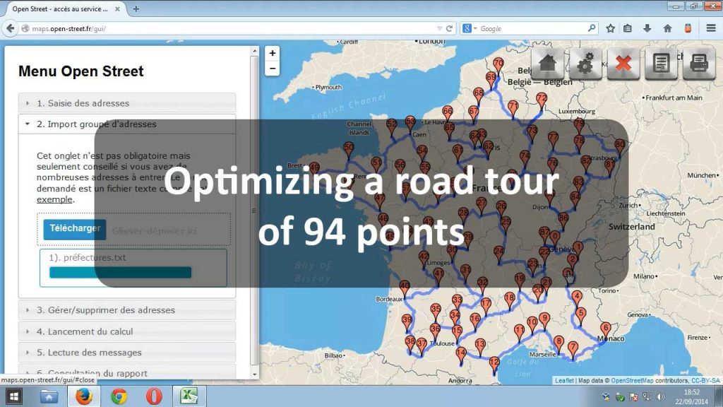
Here is a silent video demonstration of the Open Street service on the dataset of the 94 prefectures of police in Metropolitan France.

